Software Case Study
Barangay Mapping App
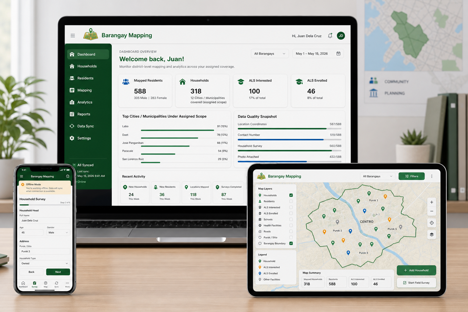
Offline-first barangay mapping SaaS for resident profiling and planning analytics.
Barangay Mapping App is a multi-tenant SaaS platform designed for barangay-level household profiling, ALS mapping, and local planning analytics in low-connectivity environments.
Problem
Local governments and field teams need dependable software for data collection, mapping, and planning even when internet access is unstable.
Solution
A multi-tenant web application that lets users collect household and resident data, capture geotagged locations, work offline in the field, and sync safely once connectivity is restored.
Built For
Barangays, school divisions, and field teams operating in low-connectivity areas.
Tech Stack
- Next.js (React)
- TypeScript
- Material UI
- Dexie with IndexedDB
- PostgreSQL
- Leaflet
- Recharts
- jsPDF
- xlsx
- PWA
- TWA (Bubblewrap)
- PayMongo
- Brevo
Key Features
- Offline-first household and resident profiling workflows for mobile devices.
- Interactive mapping for ALS learners, out-of-school sectors, and local planning analytics.
- Role-based access control, subscription billing, promotional discount coupons, and export-ready reporting capabilities.